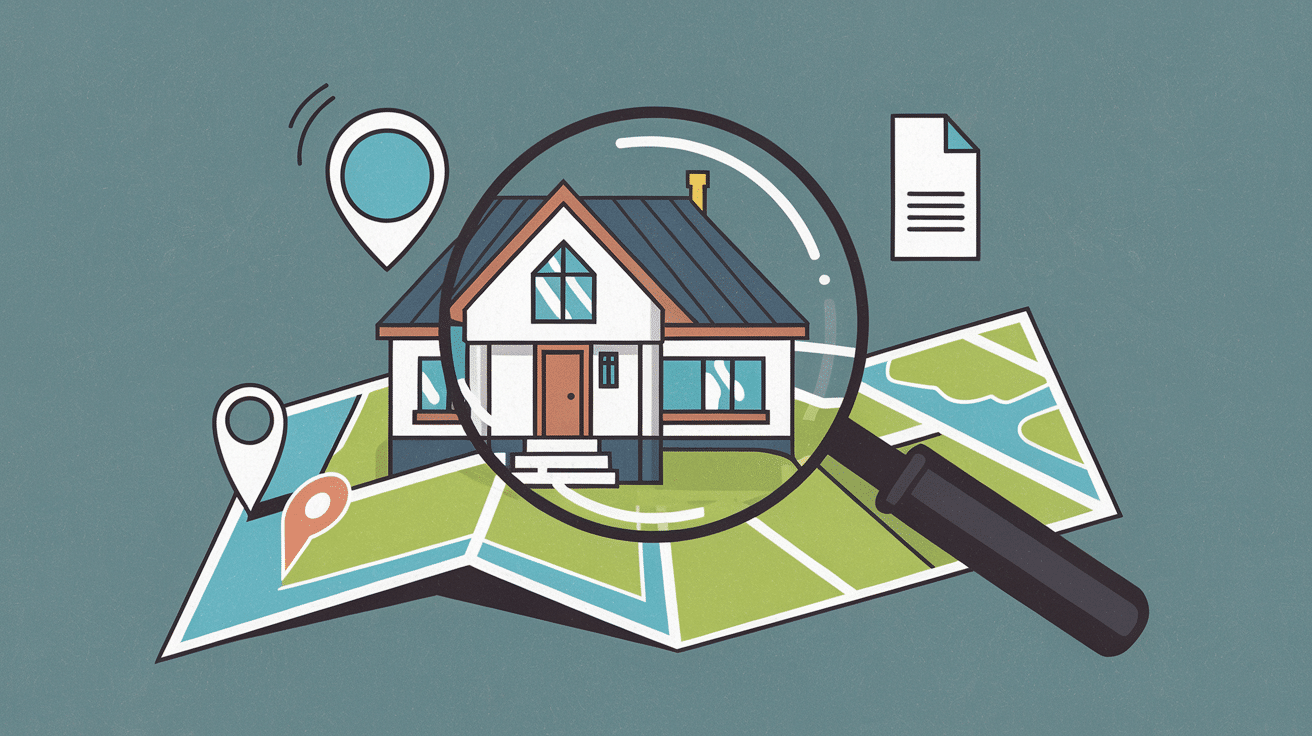

Cities need more housing. But building on untouched land triggers backlash and can cause real environmental harm. So where should growth happen?
Grey belt land offers a practical middle ground. The term is often used to describe low-value parcels within or near protected areas, such as former parking lots, abandoned sites, or degraded land of limited ecological importance.
These locations can support development without sacrificing high-value countryside.
Understanding grey-belt land helps planners, developers, and communities spot smarter growth opportunities.
This guide explains what qualifies as grey belt, how it differs from other land types, and how to identify potential sites in your area.
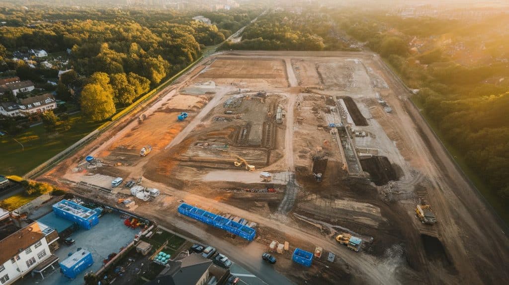
What is Grey Belt Land?
Grey belt land serves as a practical middle ground in planning conversations. These parcels often sit inside protected zones yet contribute very little to conservation goals. They may be previously developed, underused, or simply lacking meaningful ecological value.
Key points to know:
- Grey belt sites are typically previously developed or hold minimal environmental or conservation importance.
- Planners evaluate each parcel individually rather than applying a single universal rule.
- Examples include parking lots within protected zones, abandoned industrial land, or underutilized areas surrounded by existing buildings.
- These sites can support evolution without undermining broader environmental or conservation objectives.
By directing evolution toward these lower-value parcels, grey belt thinking helps preserve high-value natural areas. It allows growth to occur in locations that make environmental and geographic sense, supporting smarter, long-term land-use planning.
How Many Homes Can Grey Belt Support?

Grey-belt land makes up a surprisingly large share of land within protected zones, but much of it contributes very little to conservation goals.
While exact numbers depend on how each site is assessed, several planning studies suggest that repurposing low-value parcels could unlock a meaningful amount of housing.
In some national-level estimates, even developing a small percentage of suitable land could translate into hundreds of thousands of new homes.
The key takeaway is not one fixed number. It is the scale of the opportunity. If local authorities focus on the right parcels, grey belt land could help relieve housing pressure without pushing development into high-value countryside.
Characteristics of Land That Fits Grey Belt Potential
Not every undeveloped parcel qualifies as a grey belt equivalent. Planners search for specific characteristics to identify candidates for possible evolution.
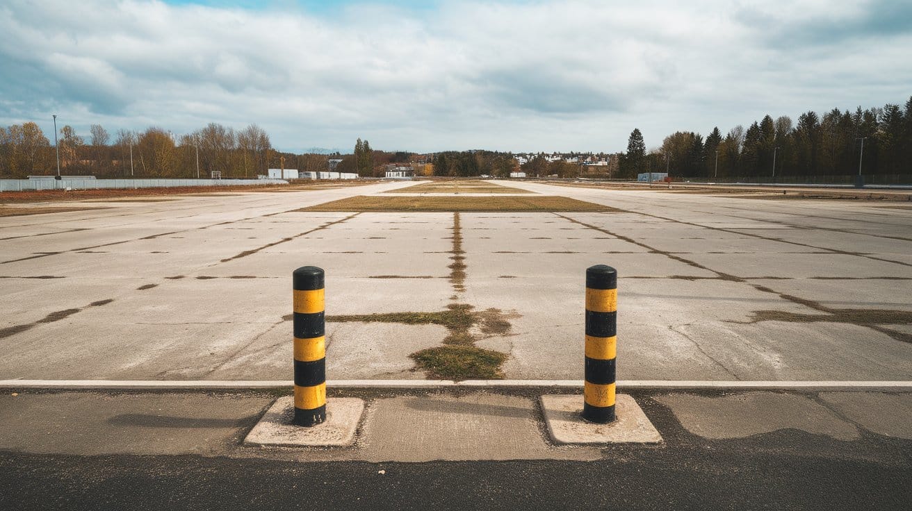
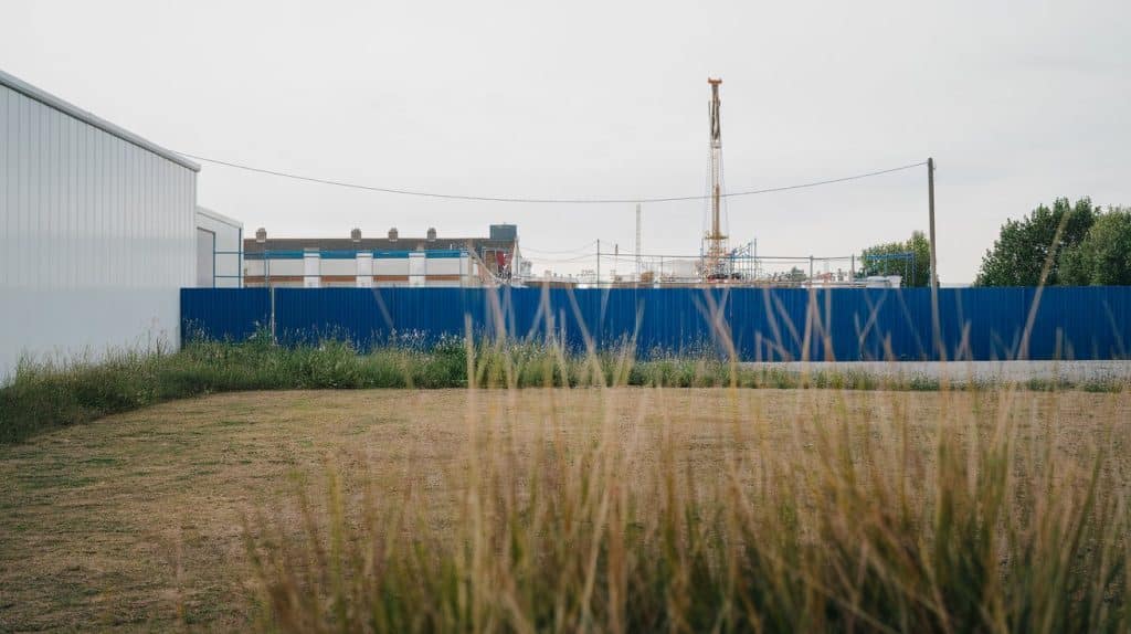
- Previously developed sites with existing structure: The old parking lots, abandoned warehouses, or vacant commercial buildings fit perfectly. The land has already been altered from its natural state.
- Sites with limited environmental value: Land containing no protected habitats or rare species may qualify. It might lack wetlands, nesting areas for endangered species, or significant biodiversity. Yet it still sits within or near urban zones.
- Parcels that contribute little to urban separation: Some parcels prevent neighboring settlements from merging. Other sites serve minimal separation purposes. The latter category offers greater evolutionary potential.
- Sites with reasonable access to infrastructure: Land near existing roads, water lines, and utilities costs significantly less to develop. It integrates more easily with surrounding communities. Isolated parcels create substantially more challenges.
- Properties near public transportation: Parcels near transit routes support denser redevelopment. They reduce dependence on personal vehicles. These sites often make sense for an investment in evolution.
Properties with heritage significance, protected status, or exceptional ecological value typically get excluded. These lands remain off-limits even under grey belt principles. Preservation takes priority in these cases without exception.
How Grey Belt Differs From Other Land Types
Understanding distinctions between classifications helps guide evolution and investment decisions. Each category comes with different rules, costs, and evolution timelines.
1. Grey Belt Land
Grey belt land is a term often used to describe previously developed or low-value parcels located within or near protected zones. These sites tend to contribute little to conservation goals, even if they fall under broader protections.
In the right circumstances, grey belt sites may support development when planners can show that impacts are limited and the wider landscape remains protected.
2. Greenfield Land
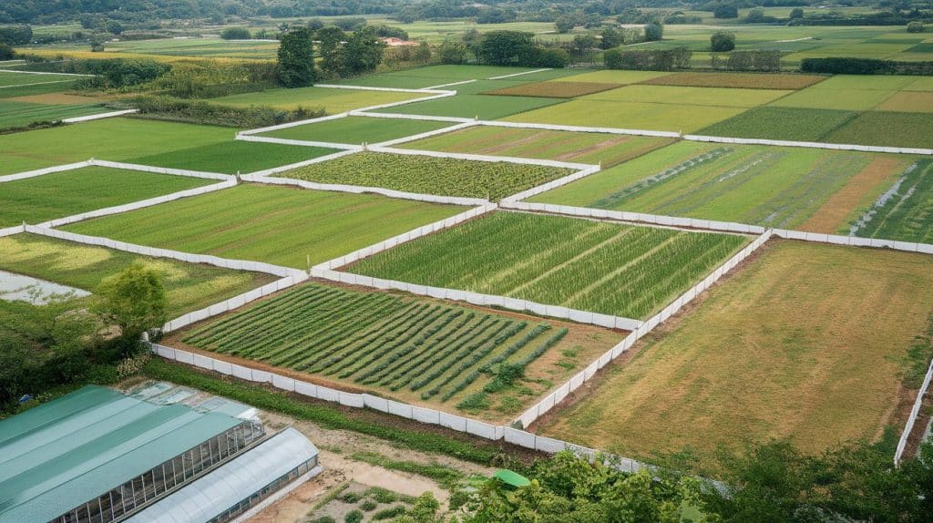
Greenfield land refers to untouched, undeveloped areas such as farmland, woodland, or open countryside. These sites often carry higher ecological or landscape value and usually face stronger planning resistance.
Building on greenfield land typically requires stronger justification, more environmental review, and clear evidence of public benefit.
3. Brownfield Land
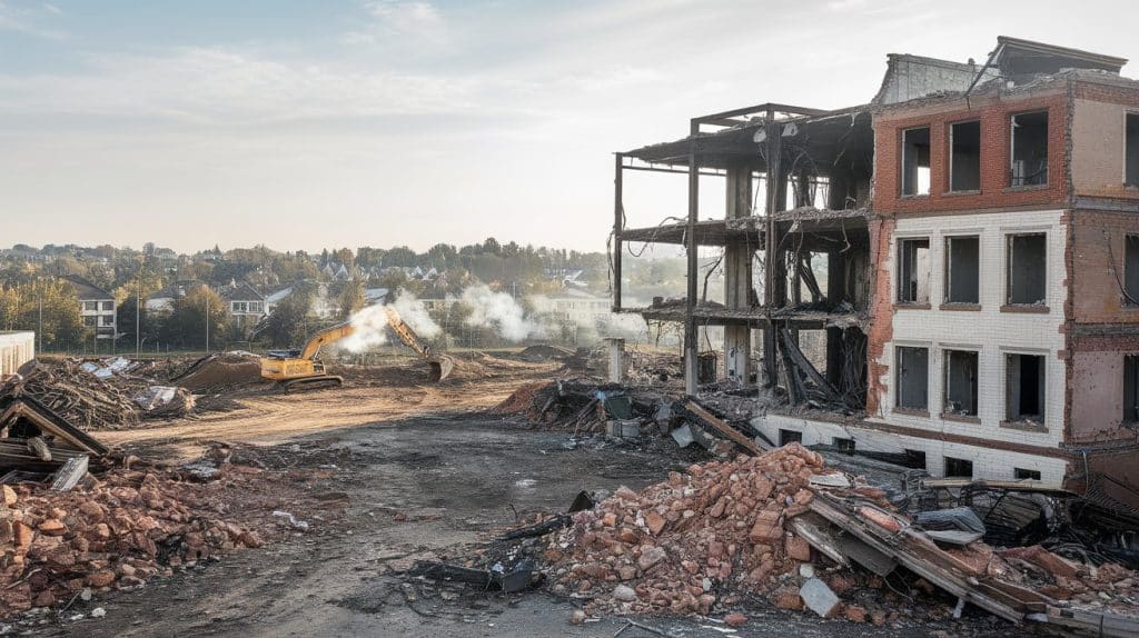
Brownfield land is previously developed land, often located in towns or cities, that may contain contamination, derelict buildings, or old industrial infrastructure.
Redevelopment is often encouraged because it supports urban regeneration and reduces pressure on open countryside. However, remediation and safety checks are usually required before construction.
Grey Belt Land and Zoning Systems
Understanding how zoning systems interact with grey belt thinking helps reveal how land evolves. These frameworks guide evolution, protect valuable areas, and allow flexible reclassification when land no longer serves its original purpose.
| Topic | Core Idea | Flexibility | Link to Grey Belt Thinking |
|---|---|---|---|
| Zoning Systems | Assigns land uses like residential, commercial, industrial, and agricultural | Moderate | Reclassification allows land use to evolve |
| Urban Growth Boundaries | Separate evolution-ready areas from preserved outer zones | Low | Grey belt parcels often sit near these boundary lines |
| Zoning Reclassification | Updates outdated or unsuitable land designations | High | Mirrors repurposing underused or low-value sites |
| Grey Belt Thinking | Focuses on low-value or previously developed land | Very high | Encourages practical evolution with minimal environmental impact |
Together, zoning tools and grey belt thinking support smarter planning by directing development toward suitable areas. This approach strengthens conservation efforts, promotes efficient land use, and adapts growth to changing community needs.
What Grey Belt Principles Mean for Different Groups
Grey belt principles help balance evolution, environmental protection, and community needs. By prioritizing underused land over sensitive areas, this approach creates practical pathways for growth without compromising long-term ecological or planning goals.
For Developers and Investors
Understanding land classifications shapes strategic decisions. Grey-belt-equivalent sites offer opportunities with fewer restrictions than fully protected areas.
These parcels often cost less than pure greenfield sites. Yet they require more preparation than brownfield regrowth. Savvy investors look for underutilized urban fringe property.
For Communities and Planners
Evaluating land individually rather than broadly protects what truly matters most. High-value natural areas are preserved for future generations.
Less sensitive sites accommodate necessary growth. This balanced approach satisfies both renovation needs and environmental concerns.
For the Environment
Responsible growth on less valuable land reduces pressure on sensitive ecosystems. Wildlife habitat, wetlands, and protected species get better long-term protection. Urban areas grow more efficiently without endless sprawl.
Grey belt principles promote balanced land use by encouraging low-impact development on less-sensitive sites, supporting economic needs, protecting natural resources, and guiding sustainable growth where it delivers the most significant benefit.
How To Identify Grey Belt Potential in Your Area
1. Physical Signs
Grey belt land often appears underused or partially degraded, with small, outdated structures, uneven boundaries, or remnants of old growth.
These areas sit on the fringe of towns and cities, where the land no longer serves a clear agricultural or ecological purpose but hasn’t transitioned into fully developed urban space either.
2. Policy Indicators
Planning documents and council assessments provide strong clues about grey belt status. Local authorities often highlight land with lower environmental value or sites suitable for future review.
These areas are not classified as core protected green belt but may still sit outside formal brownfield designation, giving them a unique planning identity.
3. Tools for Identification
- UK Planning Portal: Provides official planning information, zoning details, and application history for any site.
- MAGIC Map (Defra) – Displays environmental constraints, designations, habitats, and detailed geographic data.
- Natural England Designated Sites Viewer: Identifies protected habitats, conservation areas, and ecological sensitivities.
- Environment Agency Flood Map: Shows flood-risk levels and surface water concerns affecting renovation potential.
- National Library of Scotland Historic Maps: Reveals historical land uses, past structures, and previous renovation patterns.
- Land Registry MapSearch: Confirms property boundaries, ownership details, and land-title information.
4. Distinguishing Grey Belt from Other Land Types
A grey belt differs from an untouched green belt because it lacks significant conservation, landscape, or agricultural value. It is also distinct from brownfield sites, which have heavier infrastructure or a clear history of renovation.
Unlike rural land, the grey belt usually lies close to existing urban areas, giving it greater potential for responsible growth.
Common Misconceptions About Grey Belt Land
Common misconceptions often distort how grey belt principles work. Clarifying these misunderstandings helps planners, communities, and developers make informed, environmentally responsible decisions.
- It guarantees easy approval: Grey belt status does not guarantee approval; projects must still meet zoning rules, environmental requirements, and community standards before receiving permission.
- It means the land looks unattractive: Grey belt classification reflects planning value rather than appearance; attractive landscapes may offer little ecological benefit, while unattractive sites may be ideal for redevelopment.
- It applies everywhere the same way: Grey belt principles vary across jurisdictions; each region adapts the concept to local planning policies and regulatory frameworks.
- It means all such land can be developed: Even qualifying greenbelt parcels may face restrictions due to contamination, heritage protections, viewshed rules, or ecological considerations that require case-by-case evaluation.
- It harms the environment: Grey belt renovation supports environmental protection by directing growth toward low-value land while safeguarding sensitive ecosystems through sustainable planning practices.
Understanding these misconceptions strengthens decision-making, enabling responsible renovation while preserving essential natural areas and ensuring long-term community and environmental benefits.
Conclusion
Grey belt land offers a rare opportunity to balance growth, environmental protection, and practical land use in a world where space is increasingly limited.
By directing renovation toward underused, low-value parcels, communities can protect meaningful natural areas while still meeting housing and infrastructure demands.
Knowing these principles empowers planners, investors, and property owners to make decisions that support long-term sustainability and smarter urban expansion.
If you’re evaluating land or planning future projects, now is the time to look beyond traditional classifications and identify grey belt potential in your area.
Take the next step, review your local zoning maps, explore redevelopment opportunities, and position yourself at the forefront of responsible, forward-thinking expansion.